
Summit ZIP Code Coverage
The official material supports 07901 as the principal geographic ZIP for Summit and identifies 07902 in Summit routing practice. It does not provide a complete address-by-address boundary map, a full list of institutional ZIPs, or a citywide ZIP resident list. Treat the table as a postal research starting point. USPS remains the authority for delivery formatting, while municipal and county sources establish legal or parcel geography.
| ZIP | Areas Covered | Post Office | Notes |
|---|---|---|---|
| 07901 | Principal geographic Summit ZIP associated with Summit street addresses | Summit Post Office, 61 Maple Street | Check the exact address with USPS because the captured sources do not give a full boundary polygon. |
| 07902 | Summit correspondence and PO-box usage in routing references and local practice | Summit postal routing context | Official sources did not establish that it is exclusively PO-box-only. Verify the specific box or address. |
| 07928 | Not treated as a current Summit ZIP in the captured postal evidence | Chatham postal label after the documented change | A 2017 USPS bulletin records a change from the Summit label to Chatham, creating a historical address mismatch lead. |
A ZIP code directory can therefore identify a delivery clue without deciding municipal membership. Keep a printed ZIP, the USPS-standardized address, the municipality result, and the parcel location as separate facts. That separation prevents a postal label from being mistaken for a city boundary or an owner mailing address from being mistaken for a physical location.
Check a Summit ZIP Code First
Use USPS to standardize a mailing address, then use the New Jersey municipality lookup to test the returned location against the city context. The research identifies this as a present-day address-normalization route. Preserve the street suffix, the exact standardized output, the ZIP, and the municipality result. If a source gives only a postal city, those details make it possible to test the address without assuming that the postal and legal labels match.
Open the municipality lookup before moving from a Summit ZIP code to parcel research.
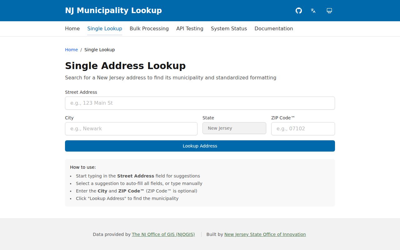
The standardized municipality result should be recorded with the source date because ZIP delivery designations can change independently of city research boundaries.
The USPS ZIP guidance explains that ZIP boundaries can change and that the lookup standardizes an address. The Summit Post Office page identifies the local office at 61 Maple Street and 07901-9998. Service hours change, so use the current postal page before making a visit.
Summit ZIP Code 07928 Change
Postal history is especially important for Summit because a documented 2017 USPS bulletin moved 07928 from the Summit label to Chatham. A historical document with that ZIP may still have a legitimate Summit-area research connection, but the postal label alone is not proof of its municipality. Compare the printed address with the municipality lookup, the tax map, and parcel records before deciding where the address belongs.
This is a geography issue, not a reason to rewrite an old record. Preserve the address exactly as it appeared in the source, then add a separate note for the standardized output and the postal-bulletin context. The same method works when a city directory, map, or deed uses Summit Township, Summit City, or a combined regional municipal label.
Find Residents with a Summit ZIP Code
No official Summit assessor, GIS, or voter interface inspected for this research exposed a dedicated ZIP-wide filter. That limit changes the method. Use the ZIP to validate one address at a time, then move through the address, block and lot, or account routes that the public tools document. The city tax query is an address, block/lot, and account search. For a set of known addresses, the Union County GIS and tax map add parcel context, while the Board of Elections remains the county route for regulated election-list questions.
- Standardize the full address with USPS and preserve the returned ZIP and, if public, ZIP+4.
- Confirm the municipality with the New Jersey lookup, especially when a postal label could cross a city line.
- Search the Summit tax query by street address, block and lot, or account number to identify the parcel record.
- Compare the parcel against the fixed-date city tax map or Union County GIS, keeping the map date with the result.
- For a historical address, use the ZIP only as a locator, then check the relevant directory, map, or deed chain. A street-level record path is available through the Summit street directory.
The NJ voter registration check uses a specific lawful verification pattern based on name and birth month and year. It is not a ZIP search. The Union County Board of Elections provides the full-file route and sets the current request procedure, while protected addresses are omitted under the cited privacy laws.
Summit ZIP Code Parcel Routes
After a Summit ZIP code has narrowed the address, parcel tools separate the property location from correspondence information. The city owner and address report distinguishes property location from the owner's mailing address. A mailing location can be outside Summit or outside New Jersey, so it cannot stand in for the parcel's situs. The useful parcel join is municipality, block, lot, and qualifier, with the street address and mailing address retained as distinct text.
| Summit tax query | Address, block/lot, and account searches; the inspected public routes do not show an owner-name or ZIP-wide search mode. |
|---|---|
| Summit Tax Assessor | Tax assessment route and certified owner/address list requests by block, with a documented $10/$11 fee. |
| Union County GISWeb | Parcel, owner, address, subdivision, sales, acreage, map-layer, and CSV-export tools. Recheck the published domain before relying on it. |
| Summit tax map | Fixed-date block and lot geography through the 2022-23 map and city maps hub. |
Use the Summit tax query after an address has been standardized.
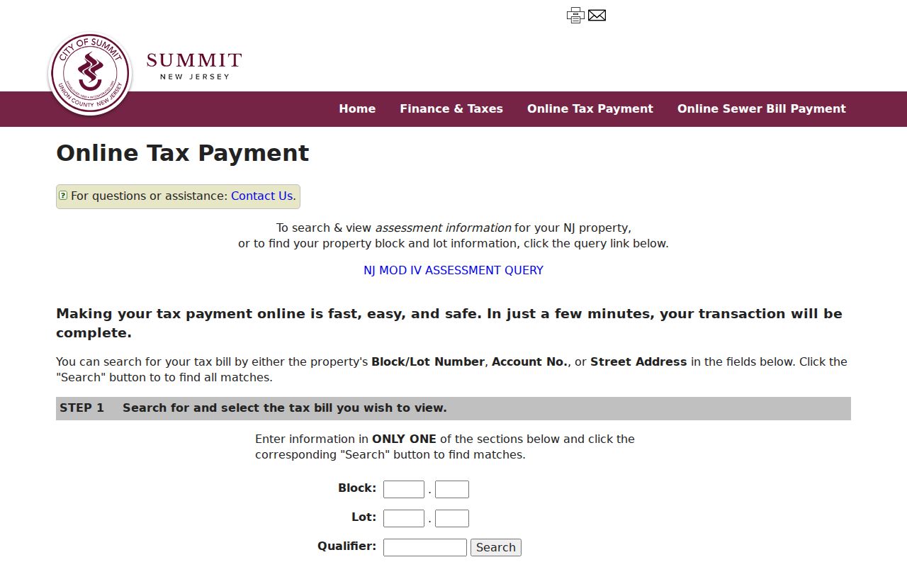
The query's address, block/lot, and account controls support parcel confirmation after a ZIP check, not a broad ZIP-wide resident search.
Summit ZIP Code Boundary Limits
ZIP boundaries and city limits are different systems. USPS formats delivery addresses. The City maps hub and 2022-23 tax map supply municipal block and lot context. Union County GIS adds spatial layers, while a deed provides legal-description evidence. No single layer substitutes for the others. When records disagree, preserve each source and date instead of selecting the result that seems most convenient.
- ZIP code
- A USPS delivery-area code used to help route mail. It does not by itself establish a legal municipality.
- ZIP+4
- An added delivery segment returned through address standardization when public. Keep it with the exact source output.
- PO-box ZIP
- A postal designation for a box address. It is a contact point, not proof of a residential or parcel location.
- Carrier route
- A postal delivery grouping. The research did not locate a public Summit carrier-route resident directory.
General-delivery and PO-box locations require the same caution. Label them as postal contact points. Do not use them to infer a physical address or a neighborhood boundary.
Documenting a Summit ZIP Code
A repeatable ZIP record keeps the postal answer separate from the property answer. This is useful for a historical directory page, a city map, or a current tax record because each may display a different kind of address. The research calls for an evidence worksheet rather than a guessed mismatch list.
- Save the address exactly as printed in the source and identify the source date.
- Record the USPS-standardized version, ZIP, and public ZIP+4 if one appears.
- Record the municipality lookup result and the date of that check.
- Capture the tax-map block, lot, qualifier, and map edition when parcel research is needed.
- Note the GIS municipality layer and any postal bulletin that explains a historical label change.
For a disputed street number, Summit's code assigns principal-structure numbering through the Tax Assessor and provides a city route for numbering issues. A separate public E911 readdressing project or countywide readdressing schedule was not located in official sources, so no such program should be assumed.
Summit ZIP Code Record Boundaries
A ZIP may help choose the right address to research, but different records still describe different relationships. A tax parcel establishes an assessed property and situs. A deed identifies parties to a conveyance. A voter record is regulated election information and does not create a historical household list. A city directory is an edited, dated snapshot. Keeping those roles separate prevents a mailing line, parcel row, or postal designation from being stretched beyond what it actually proves.
New Jersey's Open Public Records Act, N.J.S.A. 47:1A-1 et seq., provides a written-request framework for existing public records held by the proper custodian. It does not require a custodian to create a ZIP-wide resident analysis. Protected information, including Daniel's Law addresses and Address Confidentiality Program substitute addresses, must remain protected. If an official result is redacted or absent, record that limit rather than trying to reconstruct the information from unrelated sources.