
Walk a Summit Street Directory
Address work in Summit begins by confirming the municipality and preserving the street suffix exactly as used by the record. The useful chain is address to parcel, parcel to recorded instrument, and then back to dated household evidence. It does not create a current household roster. The Summit Tax Assessor query documents address, block-and-lot, and account-number routes, while the county Clerk index follows parties to a recorded instrument. A voter record may be a regulated status check or a county-request matter, not a public street-browse tool. Keep the date and the relationship shown by each source.
- Enter the situs address in the Summit tax query. If results are ambiguous, preserve the suffix and use block, lot, qualifier, or account number rather than guessing.
- Record the block, lot, qualifier, property location, and any owner or mailing field as separate facts. A mailing field is correspondence, not proof of occupancy.
- Use the parcel map to identify the mapped parcel, its adjacent geography, and the map date. Then compare the parcel identifier with the tax map.
- Search the current owner as a grantee in the Clerk index, open an available instrument image, and capture the recording date, document number, book/page, and prior reference.
- For a past household, compare a numerical directory section with a dated alphabetical entry and another record type. The historical collections are described on the Summit Directory Book.
That order prevents a common error: treating the first name on a tax card, map, or deed as the name of every person who lived at the address. Each step should leave a small source log with the address form, date searched, record relationship, and a link or citation.
Confirm Summit Address Geography
Before opening a parcel record, make sure the address is in Summit City, Union County. A postal city and a legal municipality can differ, and an owner mailing location may be outside Summit or outside New Jersey. The State of New Jersey provides a municipality address lookup for standardizing an address to a municipality. Save the returned spelling alongside the physical situs. This is especially helpful where a ZIP label, a regional directory heading, or a nearby municipality could otherwise blur the record trail.
Use the captured New Jersey municipality lookup as the first address check.
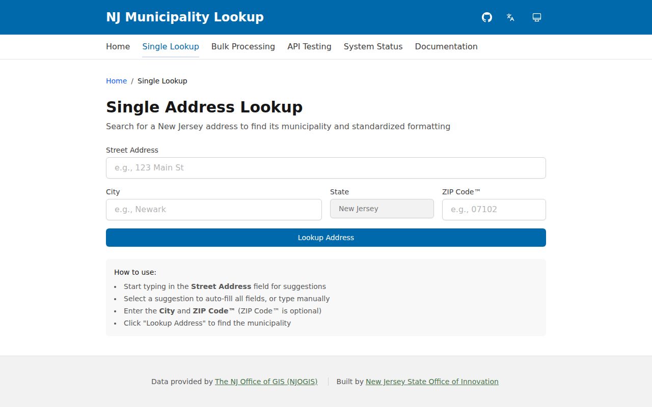
The standardized municipality result belongs with the street spelling, ZIP, and access date, before the parcel search starts.
- Parcel
- A mapped unit of property used by assessors and GIS systems. It can be identified by block, lot, and sometimes qualifier.
- Situs address
- The physical location label for a property. It is different from a correspondence or owner mailing address.
- Plat
- A recorded map or subdivision plan. The Clerk name form did not show plats as a separate checkbox, so book/page, GIS, tax maps, and the Record Room may be needed.
- Criss-cross directory
- A reverse or numerical directory that moves from a street number to a published occupant or business entry for a particular year.
Note: A municipality result confirms geographic context, not ownership, current residence, or the legal boundary of a parcel.
Search Summit Parcels by Street
The Summit tax query is the direct street-level starting point. Its documented modes are street, block and lot, qualifier, and account number. A dedicated city owner-name search was not located in the inspected official interface. When a street query returns more than one match, compare the suffix and qualifier rather than merging results. Rutgers MOD-IV and the county GIS provide separate owner, address, or parcel paths, but each should be dated because parcel data update on different schedules.
The following tax-query screen shows the address and parcel controls assigned to this Summit street directory.
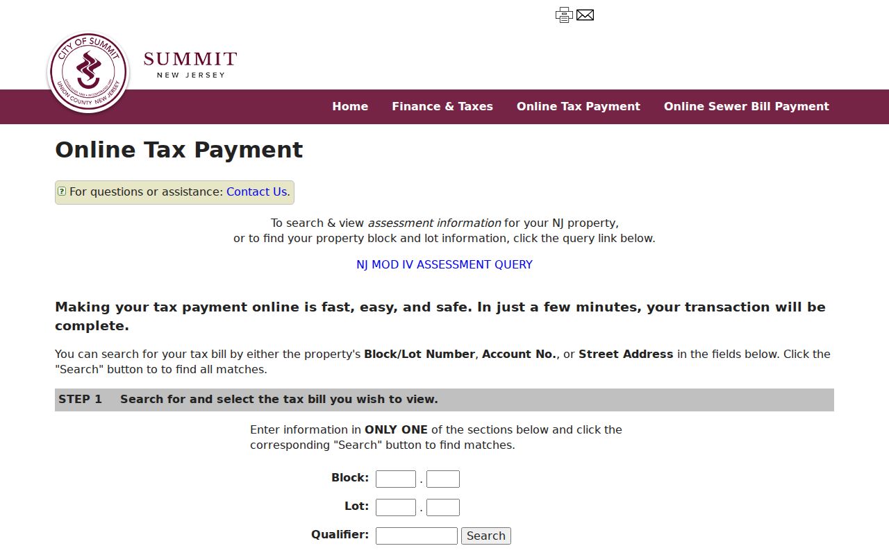
Use one search route at a time, then write down the exact block-and-lot format that produced the parcel.
| System | Field | Input | Result or caution |
|---|---|---|---|
| Summit tax query | Block and lot | Two-part entries separated by dots | Use the paired route when the street has several matches. |
| Summit tax query | Qualifier | Optional text | Distinguishes multiple interests where a qualifier exists. |
| Summit tax query | Account number | Optional route | Searches a tax bill or assessment by account. |
| Summit tax query | Street | Optional route | Suffix may need an abbreviation, omission, or a second spelling. |
| Rutgers MOD-IV | Year and municipality | Select and search | Supports parcel attributes and CSV downloads within its limits. |
The parcel card supports a limited statement: the assessor associated an owner field with a parcel on the captured date. Assessment values are not sale prices, deed consideration, a complete improvement history, or evidence that an owner lived at the site.
Read Summit GIS Along Streets
Union County GISWeb documents searches by owner name, parcel number, address, subdivision, street address, and street name. Its toolbar includes Select, Identify, map-layer controls, measurements, aerial choices, and CSV export. Start with Identify on the subject parcel, retain the parcel ID and map date, and move to another parcel only by selecting it on the map. The published link displays an nc.gov domain, so confirm it through an official county or city page at use time. If it fails, use the City maps hub, MOD-IV, the state property-transparency map, or a bounded records request.
The captured Union County GISWeb image records the available parcel and address search tools.
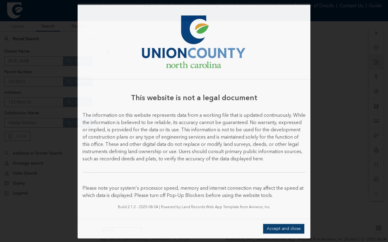
Parcel lines and aerial views provide spatial context, while the Clerk instrument supplies the legal-description evidence for title conclusions.
Aerial layers are useful for visible footprint changes, not for dates of construction, occupancy, or ownership. Zoning, flood, ward, and district overlays also describe a mapped condition rather than the people at an address. For fixed-date block and lot geography, compare the current map to the 2022–23 Summit tax map.
Follow Summit Deeds by Address
The Union County Clerk name index is the key source for the recorded side of a Summit street directory. Online land-record coverage generally begins June 1, 1977; the Record Room holds transactions from 1857 forward. A name search requires a last name and a date range, then requires a party type and at least one document type. Test the present owner as both grantee and grantor as the time period requires. Search a spouse, trustee, lender, executor, or business separately when the instrument identifies that party.
The official County Clerk index is shown here with its documented name, date, party-type, and document-type controls.
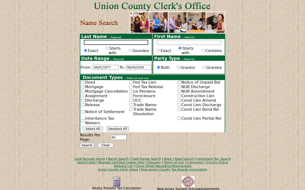
Open an available image before relying on an index result, because the result itself does not establish that a complete image is available.
| Index result | Party name and whether the party is grantor or grantee. |
|---|---|
| Instrument details | Document type, recording date, instrument number, and book/page reference. |
| Image review | Grantor, grantee, legal description, consideration or transfer-tax section, and prior-reference recital where available. |
| Next link | Compare the legal description to the tax map and follow the prior party as a grantee. |
For older books, visit or contact the Clerk Record Room, ask county staff for book/page help, or request a certified copy. The Clerk lists phone 908-527-4000 and general email info@ucnj.org. Published ordinary copies are $2 per page; certified copies are $8 for the first page and $2 for each additional page. Confirm the current schedule before payment.
Check Summit Street Number Continuity
Summit’s Chapter 14 numbering code is a useful address-continuity record. It preserves references to 1901 ordinances and a 1909 revision, assigns principal-structure numbers through the Tax Assessor, and says previously assigned numbers remain valid. The rule begins at one on the right side of the start of a street, uses odd numbers on the right and even numbers on the left, and treats separate lots separately. No citywide renumbering, street-renaming, or annexation project was located in the official sources reviewed.
The Princeton Summit Sanborn series supplies the historic map editions used to test an address against its block and street context.
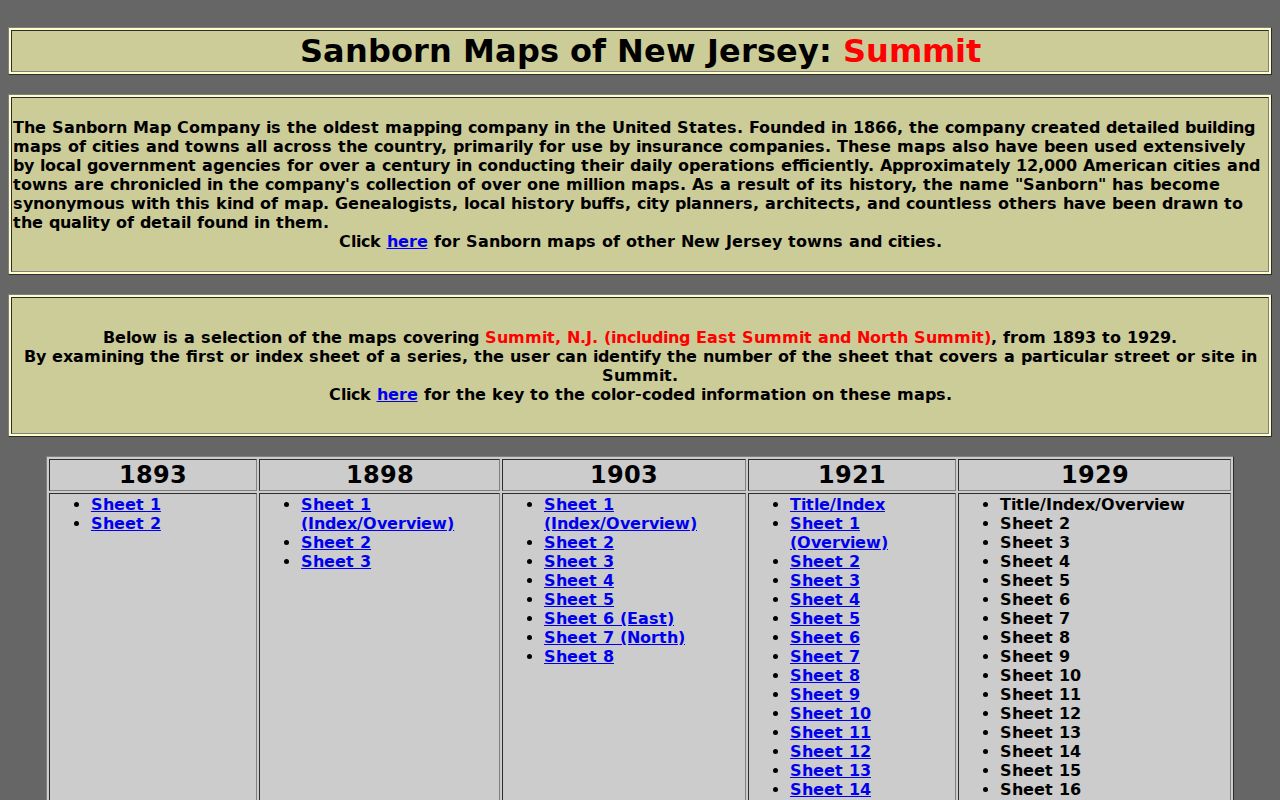
Use the series index first, preserve the edition and sheet number, and do not treat a Sanborn map as a title document.
The documented Summit editions are 1893, 1898, 1903, 1921, and 1929, including East Summit and North Summit. They can show outlines, material, use, street names, lot lines, and some house or block numbers. If a number is absent in a directory, test adjacent numbers, historical map labels, the tax map, GIS, and the deed’s legal description before deciding the address changed. Note: The code records numbering rules and validation, but it does not prove that every historic address retained the same number.
Compare Summit Address Record Sets
A street directory becomes more useful when each address-keyed source is allowed to answer only its own question. The tax roll joins a situs to a parcel identifier. GIS contributes location and layers. A recorded deed supplies parties and instrument history. Permits and planning files can date a place-related action, but their fields and retention are not fully documented in the public portal. This separation also keeps an owner, a mailing recipient, and a historical occupant from being described as the same thing.
| Address record | Custodian | Street-level evidence | Access route |
|---|---|---|---|
| Tax or MOD-IV parcel | Summit Tax Assessor / Rutgers | Block, lot, class, owner field, situs, assessment | Public query or data route; annual-update limits apply. |
| Certified owner list | Summit Tax Assessor | Assessor owner and mailing/property address by block | Separate application; $10 without a map or $11 with one. |
| GIS parcel | Union County GISWeb | Geometry, parcel ID, address, sale and layer context | Public viewer; coverage date was not stated. |
| Deed index and image | Union County Clerk | Recorded parties, date, instrument, book/page, legal description | Online generally 1977-current; Record Room 1857-current. |
| Tax map | City of Summit | Fixed-date block and lot geography | City maps hub and 2022–23 PDF. |
| Permit or planning file | City Code Administration / City Clerk | Construction, inspection, hearing, or owner-list lead | SDL Portal, archive, Document Center, or OPRA. |
The city’s owner-list application describes the per-block request and fee. It is an ownership research option when the public form’s street, block/lot, or account routes are not enough, not a substitute for a household list.
Keep Summit Voter Searches Narrow
New Jersey’s registration check uses first name, last name, and birth month and year in the documented search pattern; a middle initial may be tried with or without. The official check did not expose a street-roster mode in the research. For an eligible county list request, the Union County Board of Elections is the documented contact route. N.J.S.A. 19:31-18 identifies regulated list fields and protects covered-person addresses. An active or inactive status is an election-administration fact, not proof that a person currently lives at the address.
The Board of Elections is at 271 North Broad Street, Elizabeth, with phone 908-527-4123 and email ucboe@ucnj.org. Its published hours are 8–4 on weekdays. The statute allows a computer or electronic list to be provided to a voter for a fee not exceeding $375, but the current delivery format and form should be requested from the Board. Never republish protected addresses, signatures, or sensitive identifiers.
Request Summit Street Records
When a portal does not show a needed historical record, choose the custodian and ask for an existing, defined record. Summit Code Administration points to SDL property permit history and handles inspection requests in writing. The City Archive supports category, keyword, and date controls, while the City Clerk maintains ordinances, agendas, resolutions, and minutes. Municipal files may also be requested through the City OPRA portal; county-held records should go to the applicable Union County custodian.
Summit Tax Assessor
Use the assessment page, tax query, or owner-list request for block, lot, qualifier, and assessor record questions. City Hall is listed at 512 Springfield Avenue; the published phone is 908-273-6405.
Union County Clerk
Use the online index for modern instruments, then the Record Room, staff assistance, or a certified-copy request for earlier or missing material.
City Clerk and Archive
Use municipal archive, Document Center, or OPRA routes for dated civic, planning, and records-custody questions.
A written OPRA request must go to the proper custodian under the Open Public Records Act, N.J.S.A. 47:1A-1 et seq. Ask for a bounded address, block/lot, record series, and date range. Accept redactions and an inspection option when a volume is uncertain.
Set Limits on Summit Street Results
A Summit street directory cannot show every person tied to a home. Parcel and permit records do not enumerate household members, private occupants, utility customers, or delivery recipients. A deed mailing address can belong to an agent, trust, lender, or prior correspondence location. Motor-vehicle personal information is restricted under the Driver Privacy Protection Act, and protected addresses may be omitted from election or government datasets. The honest result is the narrow record relationship: assessor-associated owner, deed party, mapped parcel, or dated directory entry.
Lawful use. Use Summit address records for family history, property research, civic context, or personal safety. Do not use them to stalk, harass, intimidate, or expose a protected person.
For a suspicious deed-related notice, use the County Clerk’s official history and contact route. The county’s post-1977 online history and in-person or phone assistance are the appropriate checks, rather than a private mailing offer.
Note: A missing name, restricted field, or unavailable image should be recorded as a gap, not filled with an unsupported conclusion.